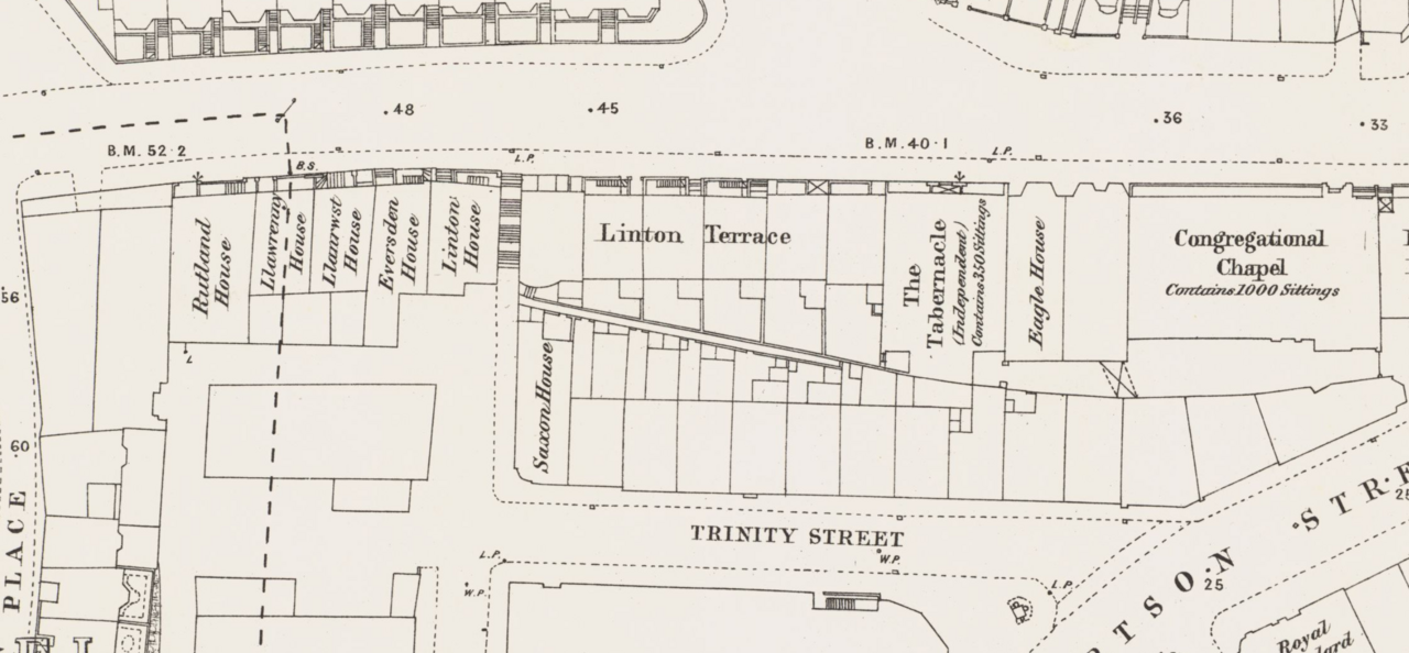
File:Linton Terrace 1873 Mapping.png
From Historical Hastings

Size of this preview: 1,280 × 594 pixels. Other resolutions: 320 × 148 pixels | 2,526 × 1,172 pixels.
Original file (2,526 × 1,172 pixels, file size: 1.96 MB, MIME type: image/png)
1873 town plan showing Linton Terrace, the Robertson Street Congregational Church, Cambridge Road, The Tabernacle and Trinity Street
Circa 1873
File history
Click on a date/time to view the file as it appeared at that time.
| Date/Time | Thumbnail | Dimensions | User | Comment | |
|---|---|---|---|---|---|
| current | 14:35, 10 October 2025 | | 2,526 × 1,172 (1.96 MB) | RoyPenfold (talk | contribs) |
You cannot overwrite this file.
File usage
The following 2 pages link to this file: