File:Fields of fire diagram.png
From Historical Hastings

Size of this preview: 1,280 × 775 pixels. Other resolutions: 320 × 194 pixels | 640 × 387 pixels | 800 × 484 pixels | 1,024 × 620 pixels | 1,413 × 855 pixels.
Original file (1,413 × 855 pixels, file size: 1.75 MB, MIME type: image/png)
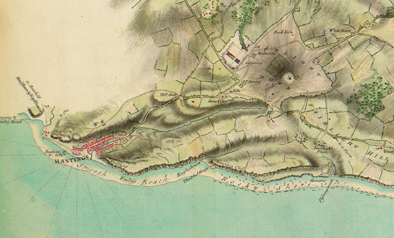
This plan gives reconnaissance information showing where on the beach it would be safe for an invading force to land; it also shows the field of fire from batteries at Hastings and Rye. Mileages from Hastings are marked along the roads in red figures against a red cross. The encamped regiments, with the colours of their facings in parentheses, are: Shropshire (green); Montgomery (blue); 13th Foot (yellow).
Source
File history
Click on a date/time to view the file as it appeared at that time.
| Date/Time | Thumbnail | Dimensions | User | Comment | |
|---|---|---|---|---|---|
| current | 23:26, 28 March 2020 | | 1,413 × 855 (1.75 MB) | Royp (talk | contribs) |
You cannot overwrite this file.
File usage
The following page links to this file: