File:1605 Map of Hastings landmarks from J. Manwaring Baines' book.png
From Historical Hastings

Size of this preview: 1,183 × 1,024 pixels. Other resolutions: 277 × 240 pixels | 555 × 480 pixels | 693 × 600 pixels | 887 × 768 pixels | 2,976 × 2,576 pixels.
Original file (2,976 × 2,576 pixels, file size: 3.06 MB, MIME type: image/png)
Summary
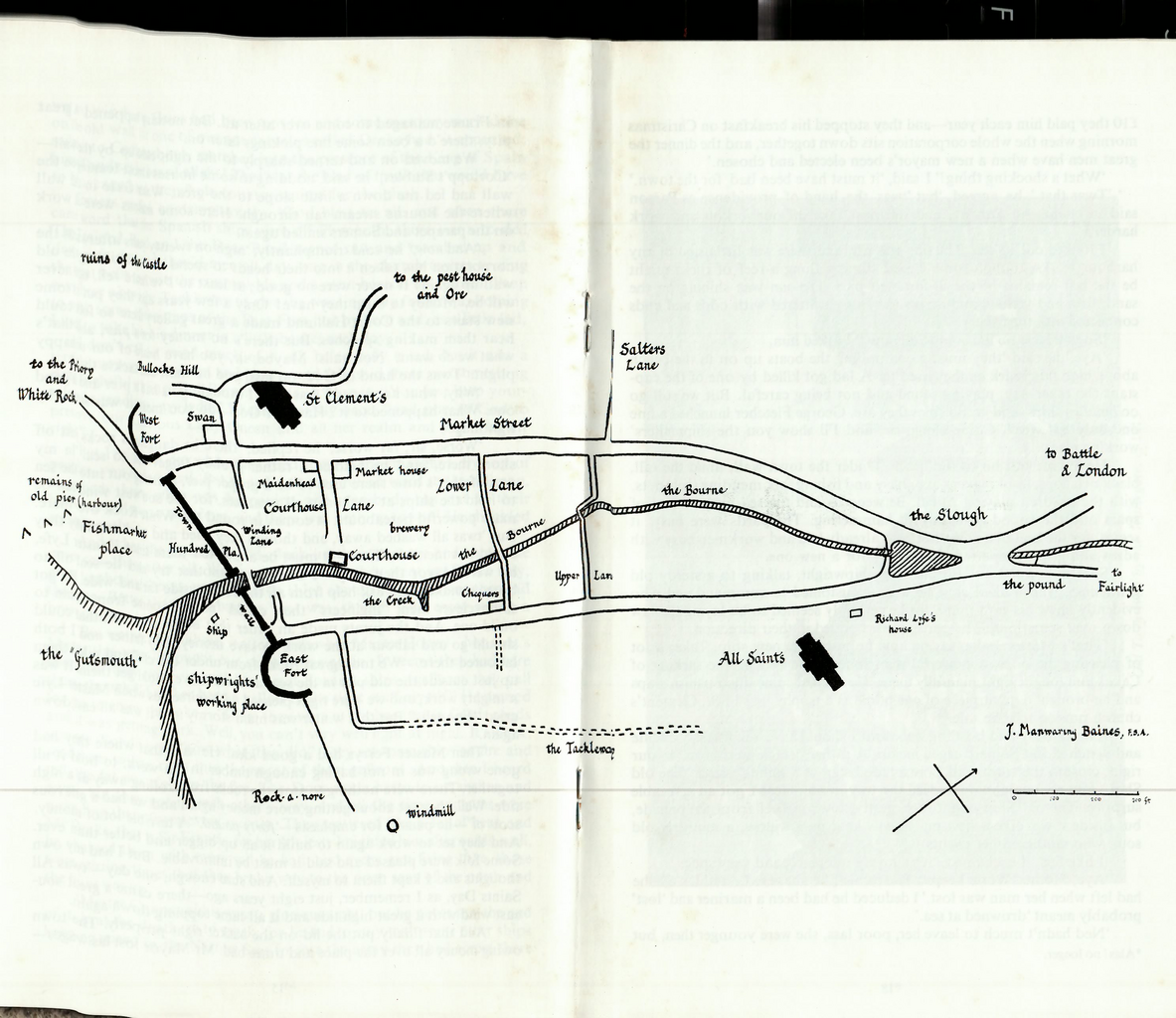
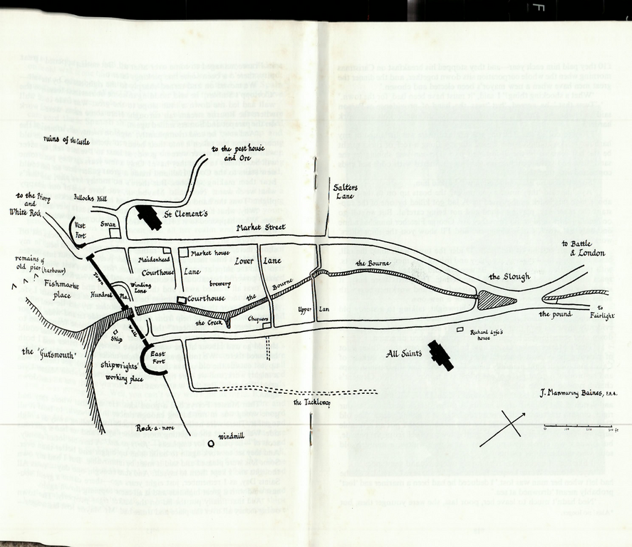
West Fort Circa 1605
File history
Click on a date/time to view the file as it appeared at that time.
| Date/Time | Thumbnail | Dimensions | User | Comment | |
|---|---|---|---|---|---|
| current | 16:03, 17 April 2020 | | 2,976 × 2,576 (3.06 MB) | Royp (talk | contribs) | {{Visible|West Fort}} {{Circa|1605}} {{VH|Town Wall}} {{VH|East Fort}} {{VH|Swan Hotel}} {{VH|Bullocks Hill}} {{VH|St Clement's Church}} {{VH|Market Street}} {{VH|Maidenhead}} {{VH|Market House}} {{VH|The Slough}} {{VH|Town Wall}}{{VH|Hundred Place}} {{VH|Ship Inn}} {{VH|Fishmarket}} {{VH|Gutsmouth}} {{VH|Winding Lane}} {{VH|Courthouse Lane}} {{VH|Courthouse}} {{VH|The Creek}} {{VH|The Bourne}} {{VH|Chequers}} {{VH|Lower Lane}} {{VH|Upper Lane}} {{VH|All Saints Church}} {{VH|Chequers}}{{VH|Sa... |
You cannot overwrite this file.
File usage
The following 11 pages link to this file: